Canadian Rockies
One month of backcountry camping in the Canadian Rockies: 427,5km of hiking, 12 film rolls, wild flowers, bears, moose, elk, mountain goats, evil porcupine, marmots, chipmunks, pika, weasels, squirrels, alpine lakes, glaciers, friendly Canadians
The Canadian Rockies are home to large populations of grizzly bears and black bears. Encounters between hikers and bears often occur. Bears are normally not interested in humans themselves, but it's the food that attracts them to tents. Parks Canada set up camping areas with bear proof food storage facilities (steel lockers or high poles for hanging the food), which are placed in the wilderness and are reservable online. They are called backcountry campings. Most backcountry campsites have a small capacity of only 4-8 tents. Therefore, even the popular trails remain quiet, which means you can encounter a lot of wildlife on the paths. However, camping spots are quickly fully booked from the moment they appear online in January. The reservation system is competitive and rather complicated to figure out. But after a lot of puzzling with the dates, and with some luck from cancellations, we managed to reserve all the trails we wanted ,(Yay!). For extra safety, it is recommended (and in some places obliged) to carry bear spray, talk loud or sing while walking.
Books and maps we used:
* Canadian Rockies Trail guide by Brian Patton and Bart Robinson (ninth edition)
* Handbook of the Canadian Rockies by Ben Gadd (second edition)
* Banff South, Banff North, Jasper South and Jasper North National Geographic maps
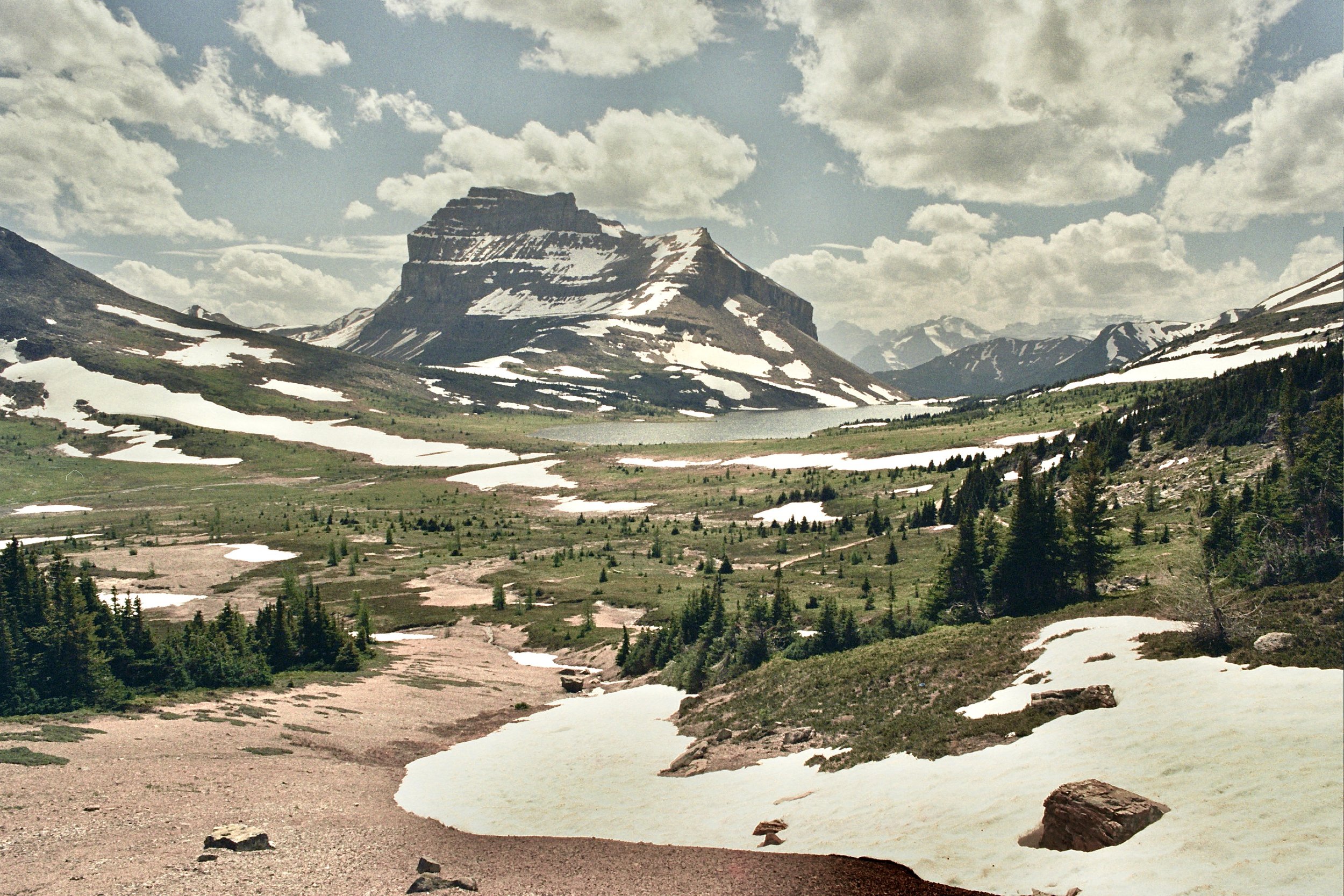
The Sawback Trail, Banff National Park 93,5km
Day 1: Norquay to Cockscomb to Mystic Junction 17km
‘We’re in bear country now’
We encountered a grizzly bear already from our first day of hiking in the Rockies. The first part of the Sawback trek takes you on an old horse trail through the forest. We had our reservations for the Cockscomb camp. However, just when we arrived a big grizzly was wandering around the camp. Daniël was busy watching birds with his binoculars. I shout ‘He’s there, he’s there! ’ Daniël: ‘Yes I see him, he has beautiful colours.’ Me: ‘Not the bird, the bear! Get the bear spray!’. The bear was approximately 20m away from us, but didn’t seem as impressed with us and we were with him. As the Canadian hikers we met taught us, we said ‘Hello bear!’ to recognise our human voice. He turned his head but then quickly continued to walk his own way. He obviously had more important business to do that day than eat us. Anyway, we didn’t feel comfortable sleeping next to a grizzly, so we walked some extra 10km till the next campground, Mystic Junction. There we met other hikers with which we had cozy campfire. Every campsite has a campfire place; the smoke helps to keep the annoying mosquitoes away.
Day 2: Mystic Junction to Larry’s Camp 13km
Second day was probably the least eventful of the trail. We mostly walked through the forest (on high alert since the bear encounter) and only shortly through alpine meadows. In the forest snow had just retreated, which allowed many spring flowers and butterflies to appear. Around Mystic Pass there was still some snow , but luckily not impossible to cross.
Day 3: Larry’s Camp to Wildflower 27,5km
‘Porcupines are assholes’
Since we couldn’t find free spots at earlier campings, we made reservations for Wildflower camp, skipping two other camps on the way. We left Larry’s Camp at 7am and arrived at Wildflower at 9pm. So the third day was quite long and exhausting. On the way we had a short detour to Luellen Lake, a great spot to have our second coffee of the day. But the highlight of the day was surely Pulsatilla Pass; marmots, chipmunks and ground squirrels entertained us while up there. We again spent the evening with two friendly Canadians from Calgary, Emily and Daniel (the only other tent at Wildflower), chatting cozy around the campfire. When we return to our tent I notice something moving in the dark. I tell Daniël there’s something next to the tent, but again he thinks I stress for nothing. When we shine with the headlight we see a big porcupine. We observe him for a little while together with our camp neighbours, then go to sleep. Maybe half an hour later, around midnight, I hear the porcupine chewing and I wake up Daniël. We try to scare him away because we were worried he would destroy our tent, but the porcupine is not afraid. We try to sleep, but again, we hear the porcupine chewing, this time in the storage department of our tent. We then move all our stuff inside the sleeping compartment of the tent and that’s when Daniël notices the porcupine ate his hiking boots (probably when we were away having dinner. Daniël was wearing sandals but luckily I kept my hiking boots on so my shoes survived the porcupine attack). Even when there was nothing left for him to chew, the porcupine still came inside the tent’s storage compartment just to hang around. We had to wake up many times to send the porcupine away, that we barely managed to sleep. In the morning Emily and Daniel showed and told us how the porcupine ate their waking sticks and made holes in their water sack. We learned from them that on some parkings in Canada you need to put barbed wire fencing around your car so the porcupines don’t chew your tires.
Day 4: Wildflower to Merlin’s Meadows via Deception Pass 13km
In the morning at Wildflower camp we had another unexpected guest, a curious deer; called mule deer because of its big ears. Daniël fixed his shoes temporarily with some duck tape. Because of lack of sleep from the night of the porcupine attack, we were quite tired through the day and walked rather slow. We had our lunch and short rest at Baker Lake. Another beautiful turquoise alpine lake. Deception Pass also had some patches of snow, but we managed to cross it. The views in day 4 were some of the best of the whole trail; ‘gorgeous’ as Canadians would say. Merlin’s Meadows camp was a mosquito hell, so we hid inside our tent and slept pretty early.
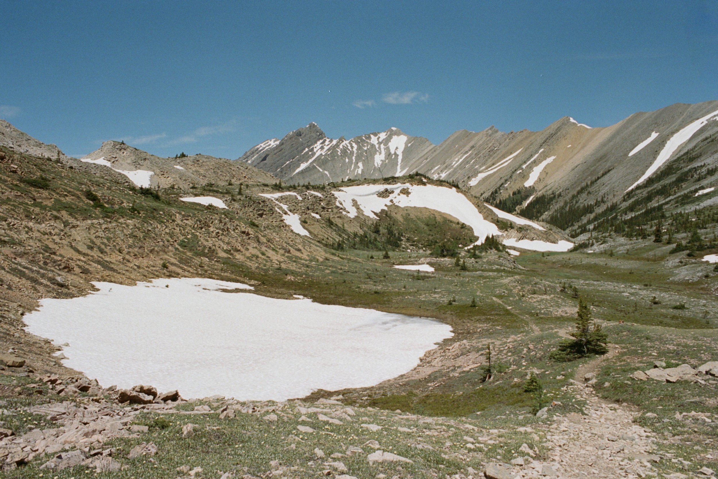
Day 5: Merlin’s Meadows- Merlin’s Lake- Hidden Lakes via Packer’s Pass 15,5km
The scenery in the last day was beautiful. It was not marked on our map and was not part of the classic Sawback trail. We passed eight alpine lakes, which we could enjoy completely by ourselves. Around 2am I woke Daniël up because I heared the chewing again. And indeed, just outside our tent there was another porcupine standing. He kicked down our walking sticks which were standing straight up in the ground and chewed off all the rubbery part where you hold your hands around. They seem to like everything that’s covered in salty sweat.
Day 6: 7,5km walking out
After a short walk out, we caught a ride back to Banff with a local couple that we met on the trail. They were very friendly to bring us all the way to our frontcountry camping in Banff. Public transportation is very limited, so we have to rely on hitchhiking for getting to the trailheads and out.


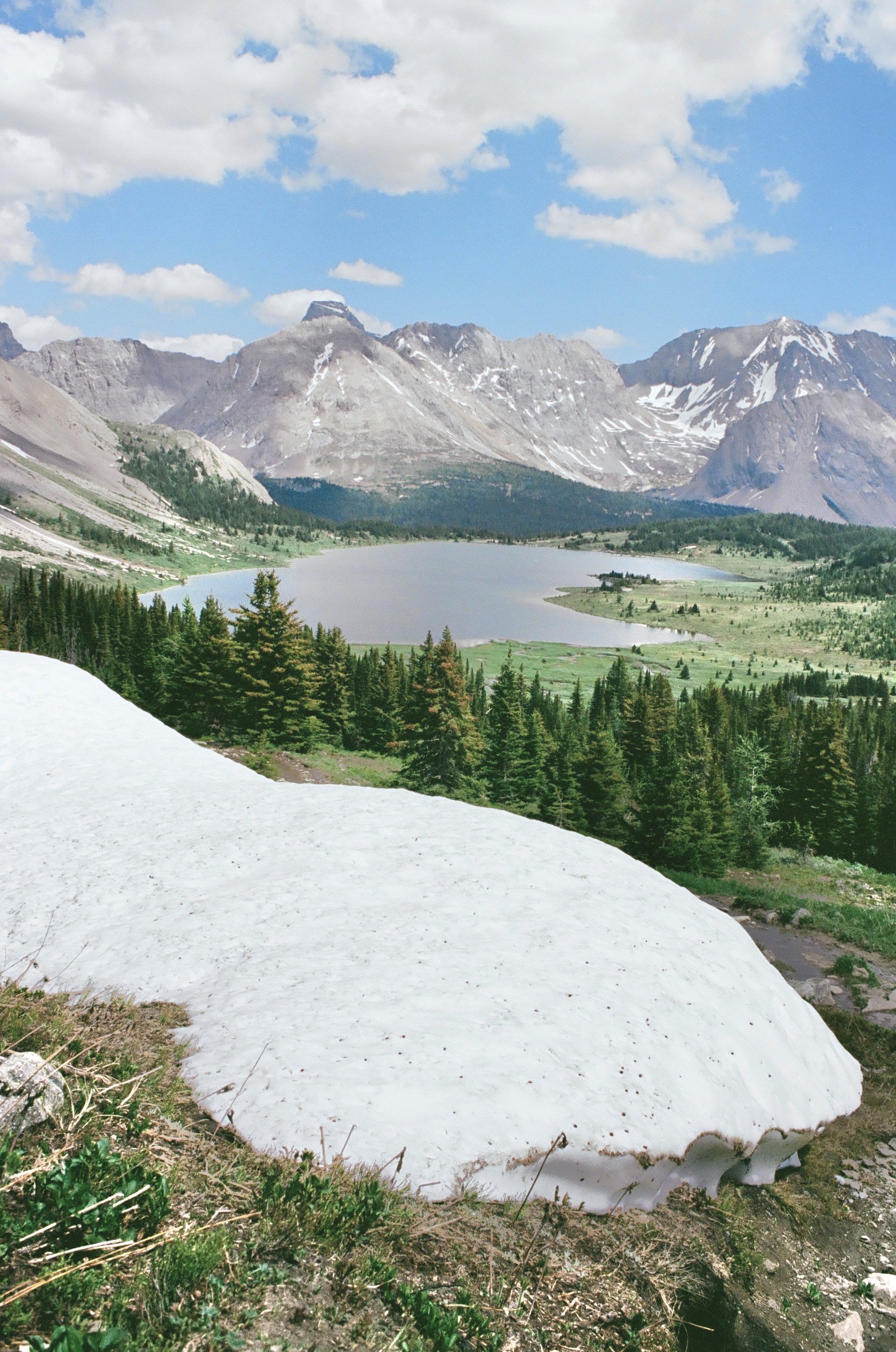


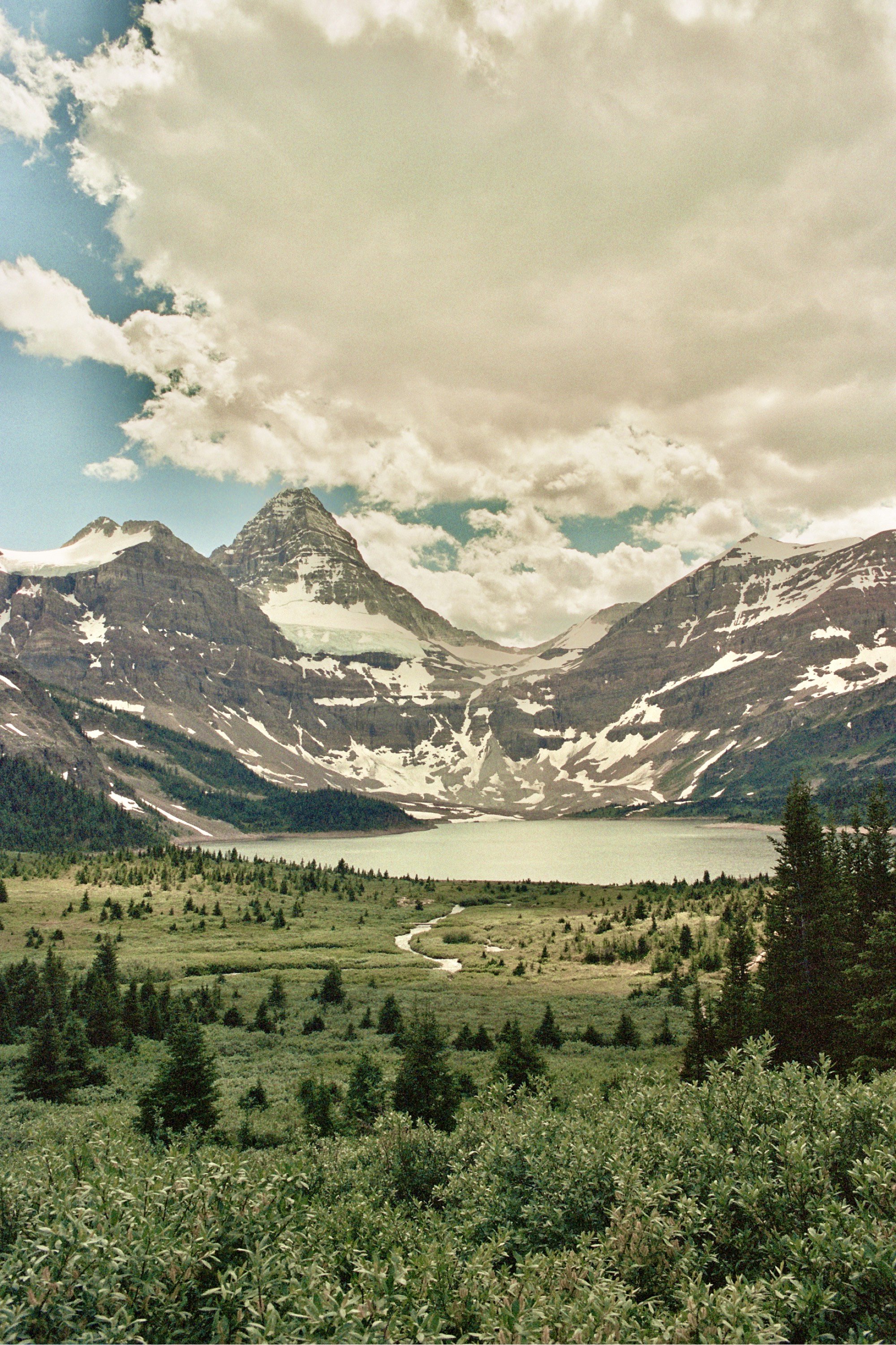
Mount Shark - Assiniboine Mt. - Sunshine Meadows - Shadow Lake, Peter Logheed Provincial Park, Assiniboine Provincial Park and Banff National Park 103km
Day 1: Mt.Shark trailhead - Marvel Lake Campground 13km
In the morning we took the free bus in Banff from our frontcountry camping to the centre and then another local bus to Canmore. Just when the bus was exiting the town, a black bear popped out of nowhere and the driver had to break suddenly and let him cross the street. We bought our food supplies for the following 8 days at the Nutters shop in Camore. Then we took a bus till the end of the town. From there we had to hitchhike 44km on a gravel road to the trailhead. The walk to the first camp was easy going, through the forest.
Day 2: Marvel Lake Campground - Og Lake 20km
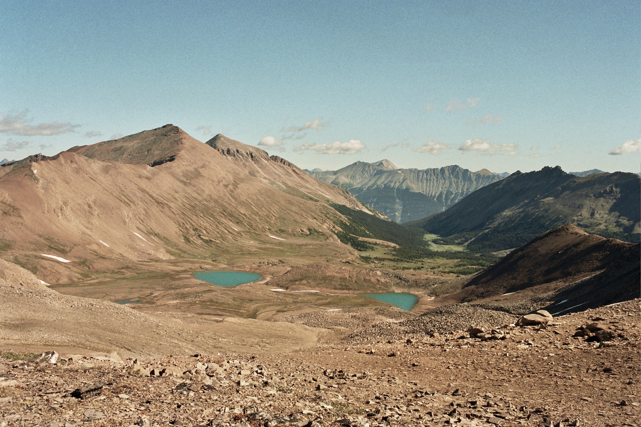
We started the day with a short walk to beautiful Marvel Lake, then had a steep ascent to Wonder Pass. On our way we passed many colourful flowers. In the forest: yellow columbine, arnica, blue camas, wild strawberries, bunchberry… In the alpine meadows: paintbrush, alpine forget me not, mountain avens, globe flower, valerian, alpine laurel… On glacier clearings: glacier lily, shrubby potentilla, silky phacelia…The other side of the mountain was covered in chalice flowers and fluffy trees, larch. The highlight of the day was Mt. Assiniboine. We gazed at it for two hours, spotted an osprey flying around and watched the clouds moving. The last 5km to our campsite took us through friendly alpine meadows.
Day 3: Og Lake - Porcupine camping 9km
Short walking day. Then some rest and reading. Too many mosquitoes to be outside for too long.
Day 4: Porcupine - Healy Creek 20km
The first challenge of the day was a steep climb to Citadel Pass. Next to Citadel Lake we had some snacks, then moved on to Douglas Howard Lake and Rock Lake. We crossed Sunshine Meadows, and hurried down to our camp, Healy Creek, before the rain started.
Day 5: Healy Creek - Egypt Lakes - Shadow Lake 23km
At 7am, we had the usual breakfast, porridge (oats with powder milk, goji berries and nuts) and a cup of instant coffee with powder milk. At 8am, after breaking down the tent and packing our backpacks, we started to climb towards Healy Pass. On the way we passed some beautiful flower meadows. Descending from Healy Pass, we arrived at Egypt Lake, a good place to have a short break and a snack. Then we started to ascend the second pass of the day, Whistling Pass; with a short detour in the middle of the climb to Scarab Lake. The climb to Whistling Pass was quite steep, but the views rewarding. On way down there was still some snow left, so we had to walk carefully. From Haidouk Lake to Shadow Lake (our camping for the night), the trail was rather easy going. We only had a short break to put our feet in the water. We arrived at the camp at 6pm and had noodles for dinner with friendly camping neighbours. All evening we heard screaming like sounds, probably ravens imitating humans.
Day 6: Shadow Lake - Castle Mountain Junction 18km
We woke up very early (6am) to be able to hike out, because the same day we had to start another trail, 140km away (Brazeau). We climbed to Gibbon Pass, then descended and made a small detour to Twin Lakes. The terrain after the lakes was boggy and muddy for about 2-3 km, the path was not always evident, so it took us a little while to traverse.


Brazeau, Jasper National Park 54km
Day 1: Nigel Creek - Boulder Creek 12km
We started the Brazeau trail in the same day we finished our last trek. So in the morning we hiked out 18km from Shadow Lake to Castle Mountain Junction, then walked 2km on the highway till the Roam bus stop, then took the bus to Lake Louise where we had lunch and charged phones and powerbank, then walked 2km on the car road out of Lake Louise, then hitchhiked 120km on Icefields Parkway to Nigel Creek (the starting point of the Brazeau trail), then walked 12km till our first camp, Boulder Creek. A crazy day! About 35km of walking and 140km of driving… We set up camp just before dark, around 9:30pm.
Day 2: Boulder Creek - Jonas Cutoff 21km
Again a long day, but with beautiful landscapes. We got very excited because we spotted a moose for the first time. It was a full day of climbing, and only the last 3km from Jonas Shoulder Pass, descending. Weather was cloudy all day but luckily we only had rain for about half an hour. We traversed alpine meadows with white, yellow and purple heather and crowberry and gravel slopes with pretty pink moss champion.
Day 3 + 4 (walking out) Jonas Cutoff - Poboktan - Sunwapta 21km
The walk out was mostly through the forest. We passed some nice waterfalls. From Sunwapta we hitchhiked to Canmore with a nice Ukrainian couple. We had two stops on the way, Columbia Icefield and Lake Louise. In Canmore we resupplied at Nutters and then hitchhiked with a lady from Ottawa to our Hi Wilderness Hostel at Castle Mountain, where we finally showered and did our laundry, yay.

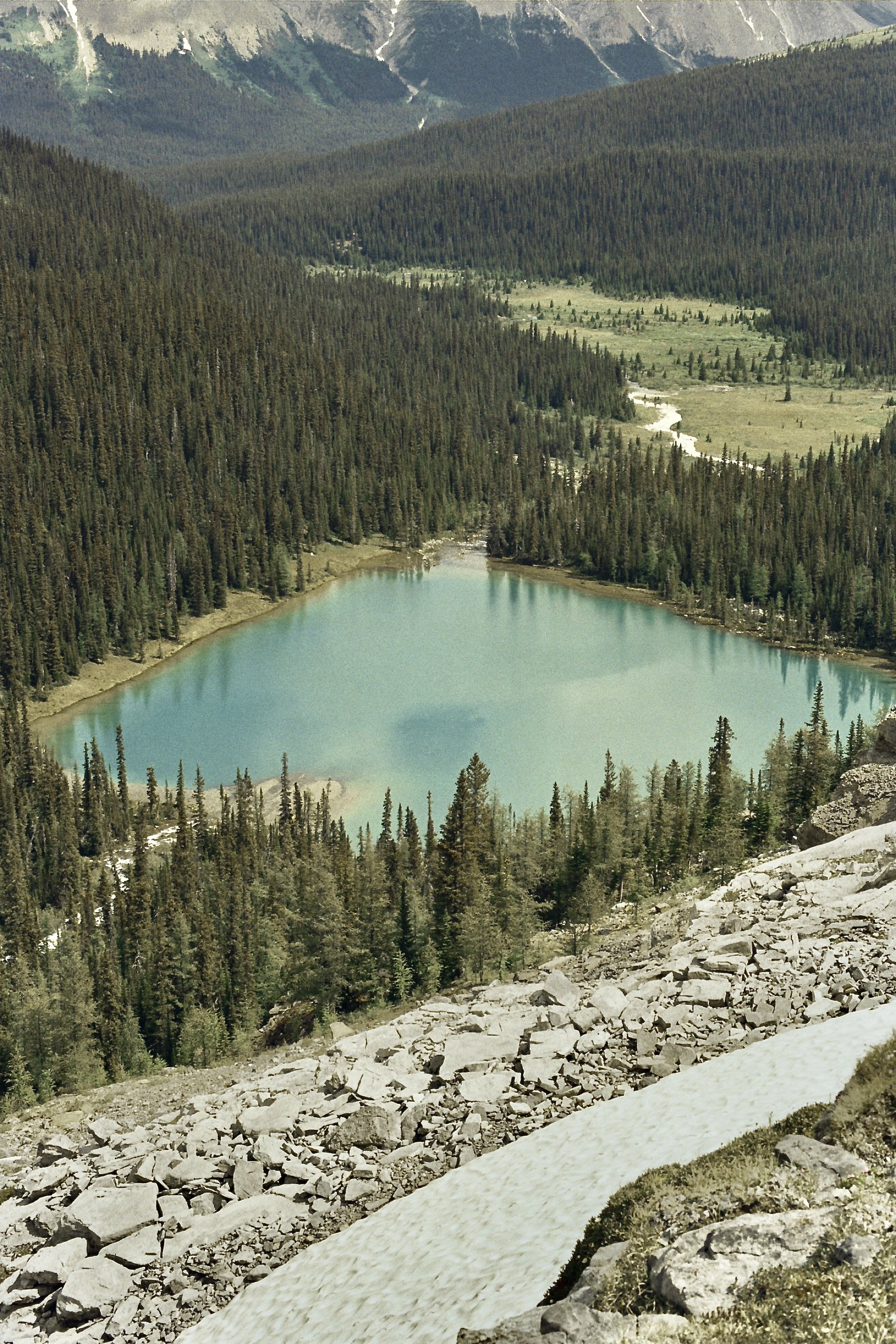
The Rockwall Trail, Kootenay National Park 69km
Day 1: Numa Falls - Numa Creek + Marble Canyon and Paint Pots 10km
We got a ride to the trailhead from an American man, Mark the meteorologist, who we met at the Hi Castle Mountain Hostel. On the way we also stopped and did two short hikes together, the Marble Canyon and the Paint Pots. The hike to our camp started next to a nice waterfall, Numa Falls. The heat was extreme, so despite the short distance, hiking with heavy backpacks was very tiring. The forest we walked through was in most parts destroyed by wildfires, so we had almost nowhere to hide from the intense sun. The annoying mosquitoes we met on the other trails were replaced with annoying flies. Especially the huge horse fly. When a black fly bites you, he takes a little piece of your skin, and you get a big red itchy lump that lasts a week long (I was the victim of such an attack, auch!). In the evening at the camp we met again friendly Canadians who gave us their dehydrated food because it was their last day of camping. Canadians are awesome, everyone we meet is cheerful and friendly.
Day 2: Numa Creek - Numa Pass - Floe Lake - Numa Creek 20km
Finally a day of hiking without backpacks! Normally we should have camped at Floe Lake, but because the campground there was full, we reserved instead two nights and Numa Creek and from here did an up and down hike to Floe Lake over Numa Pass. On our way we stopped in the prettiest and most colourful flower field; Daniël was happy to identify all the plants. In the background of the field a beautiful waterfall was coming down the mountain. When we returned to our camp we discovered that a small rodent made several small holes in our tent.
Day 3: Numa Creek - Tumbling Creek - Helmet Falls 21km
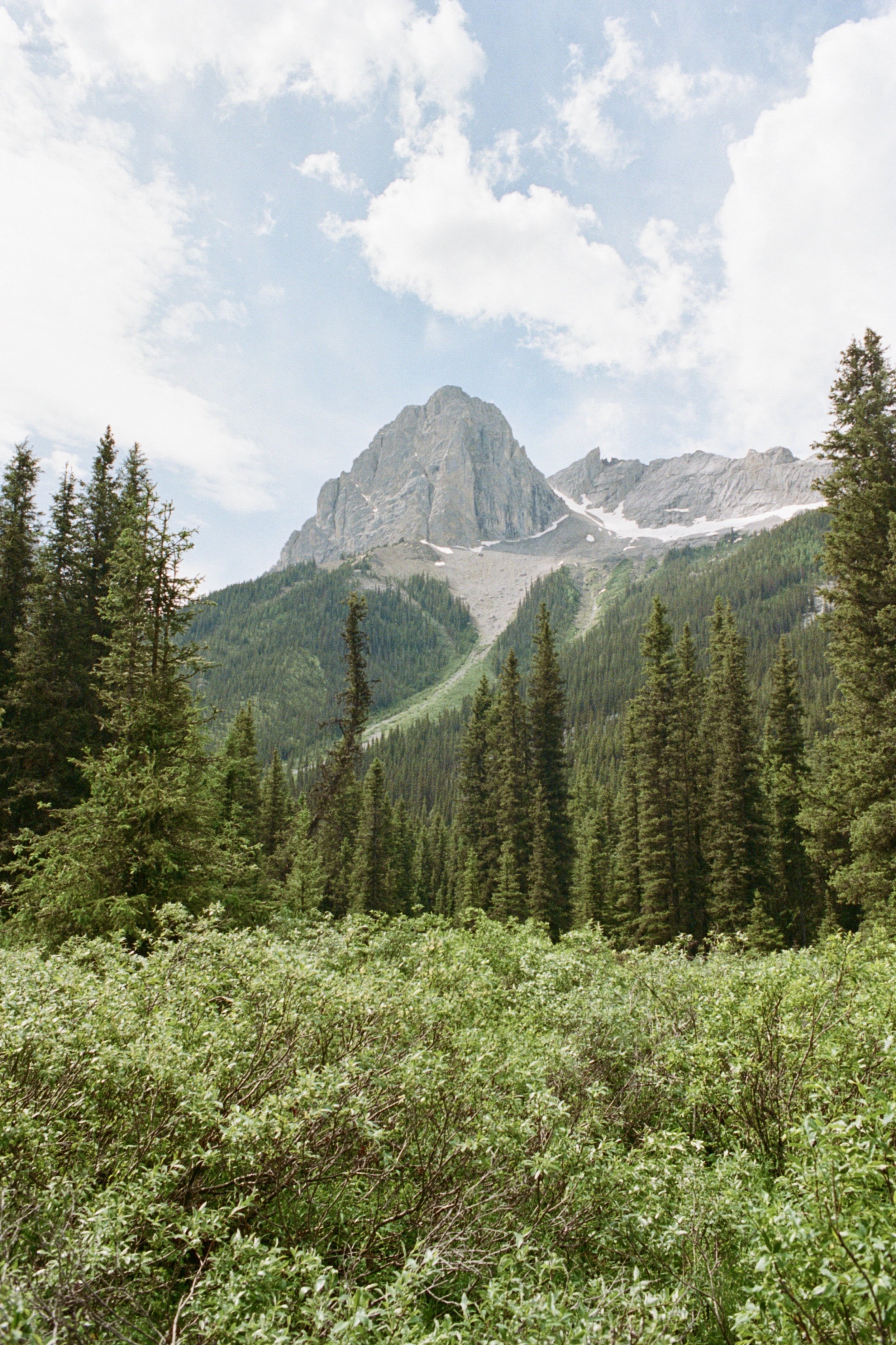
Surely the most challenging day of the trail. We had to climb up to three passes: Tumbling Pass, Wolverine Pass and Rockwall Pass. We started very early in the morning to avoid the heat. After we made our way through dense vegetation (ferns, cow parsnip, willows, honeysuckles…), a scree slope and a larch grove, we finally arrived at the spectacular sight of Tumbling Glacier. In the valley towards Wolverine Pass, we could admire the imposing Rockwall - a 600m tall cliff of limestone and dolostone.
Day 4: Helmet Falls - Paint Pots 18km
We did a morning walk to the nice Helmet Falls, a waterfall 2 km from our camp. The sun was painting cheerful rainbows in the vapour that came from the waterfall. Then we walked out, mostly through the forest. Heavy heat, but we washed a little in the river to cool down.


Edith Cavell, Jasper National Park 20km
We took a ride out of the Rockwall trail to Lake Louise with a couple from Calgary that we met at the Helmet Falls campsite. In Lake Louise we had fluffy pancakes with maple syrup and a real coffee (when camping we drink instant coffee) for breakfast. Then we hitchhiked on the Icefields Parkway all the way till the HI Wilderness Hostel Edith Cavell, where we booked two nights, our rest days. On the road we saw a cute baby black bear. When tourists stop their cars to take photos of the wildlife along the highway, locals call it a ‘bear jam’. Getting close and taking photos of bear, elk, moose or other wild animals is highly discouraged by Parks Canada. Most of the road we drove with a friendly Canadian-Nigerian man, then the last few kilometres on a smaller road with two Belgians on holiday. Typical Belgian, their car trunk was full of beer. They were friendly to offer us some cans of beer too, which we enjoyed cold in the evening. It was the perfect timing to sleep in a cabin instead of the tent, because after three weeks of sun, it was now very rainy. Next day we had a nice hike around Angel Glacier. The second night we were the only guests in the cabin; we spent a cozy evening exchanging travelling stories with the two friendly staff members. In the morning, one of the guys, Aaron, drove us to Jasper. We had breakfast at Bear’s paw bakery: cinnamon buns, scones and coffee. In Jasper we also bought food at Nutters for the next hike, then walked a few kilometres out of Jasper till a good hitchhiking point to Maligne Canyon. On the way we encountered a beautiful female elk. We got a ride from an English couple on holiday to our HI Wilderness Hostel at Maligne Canyon, where we spent the night.


The Skyline, Jasper National Park 88km
Day 1: Maligne Canyon loop & Maligne Lake - Evelyn Creek 11,5km
In the morning we walked the Maligne Canyon loop (very close to our HI Wilderness Hostel). Then we hitchhiked to Maligne Lake on a beautiful road. The walk from Maligne Lake to our first campsite was rather short, so we took small detours to Lorraine Lake and Mona Lake. We put up the tent just before the rain started. We spent all afternoon and evening reading in the tent because of the constant rain.
Day 2: Bald Hills & Evelyn Creek - Little Shovel 16km It rained all night and all morning, but around noon it cleared up. Before walking to our campsite for the day, we did a nice walk without backpacks to Bald Hills and back, where we had a nice view over Maligne Lake. Terrain was quite muddy after the rain. We intersected with a few cute pikas.
Day 3: Little Shovel - Watchtower 13,5km We crossed a valley full of yellow flowers, arnicas, and climbed up to three passes: Little Shovel Pass, Big Shovel Pass and Watchtower Pass. As usual, marmots, chipmunks and ground squirrels greeted us along the way.
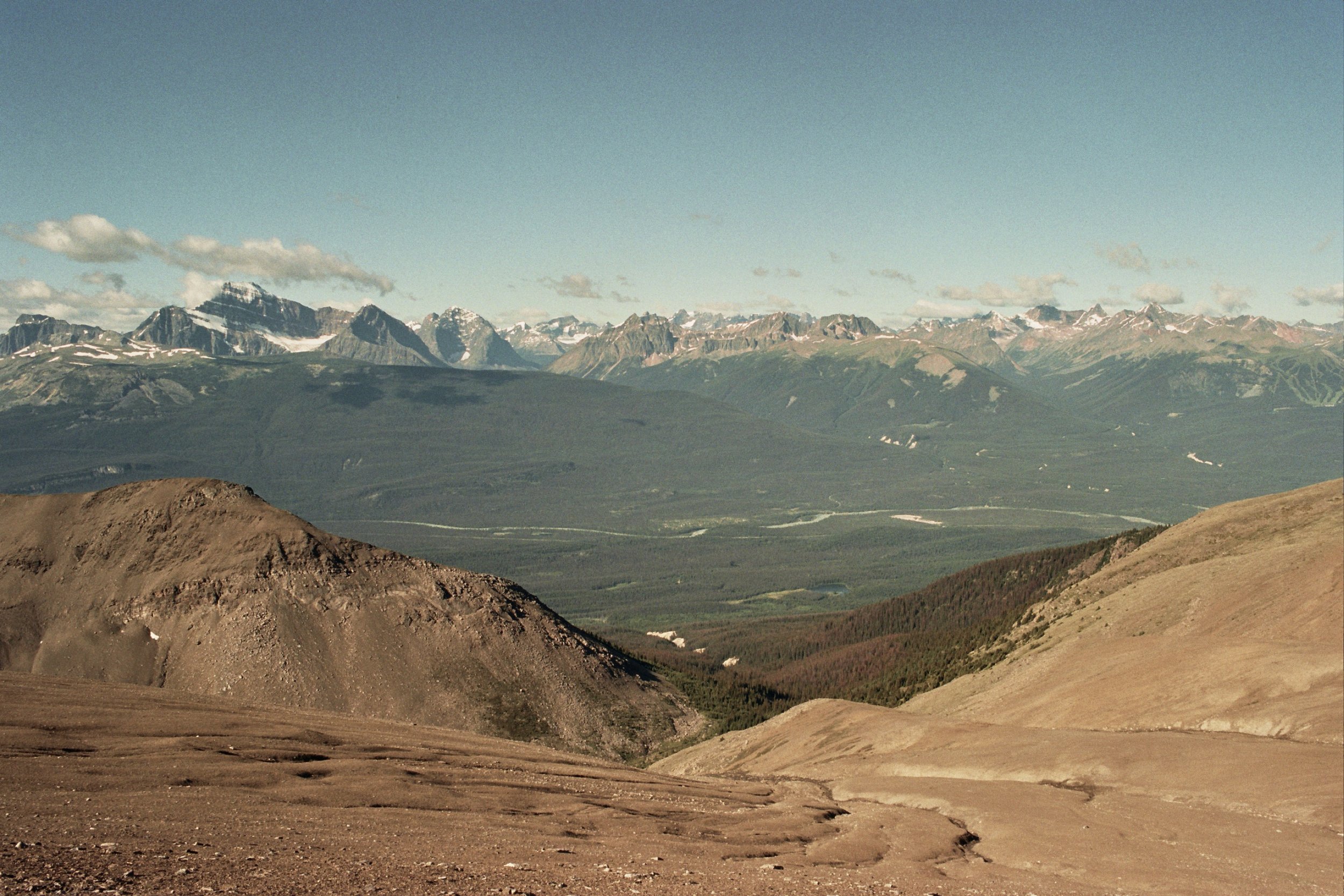
Day 4: Watchtower - Signal 23km Probably the most beautiful day of the Skyline trail. Early in the morning we climbed to Watchtower Pass (again). After a steep climb up from Curator Lake, we walked for a long time on the windy ridge, where we had beautiful panoramas. On the rocks we met a lovely ptarmigan mother with babies.
Day 5&6: Signal - Whistlers campground - Hi Hostel Jasper 24km
We walked out through the wildlife corridor. In celebration for completing all our trails in the Rockies, we had dinner at the Elk Lodge restaurant: tacos, tortillas with guacamole and margaritas.