Iceland
One month in Iceland: 30 nights of camping, 380 km of hiking, 1500km of hitchhiking, 12 film rolls, an erupting volcano, lava, glaciers, arctic foxes, seals, humpback whales, puffins, bird cliffs, moss, ice, fog, fumaroles, colourful rocks, waterfalls.
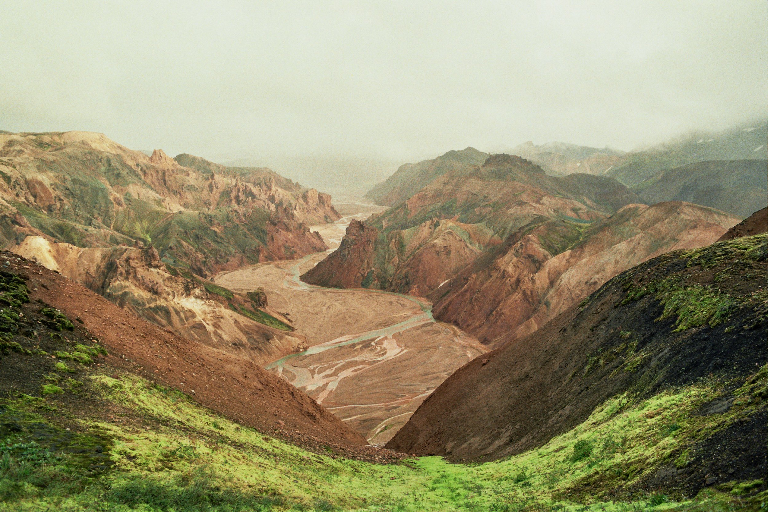
Kerlingarfjöll circuit (+extra) 60km
Ásgarður-Hveradalir-Klakkur-Efri Kisubotnar-Ásgarður
Our first trekking in Iceland was the three days Kerlingarfjöll circuit.
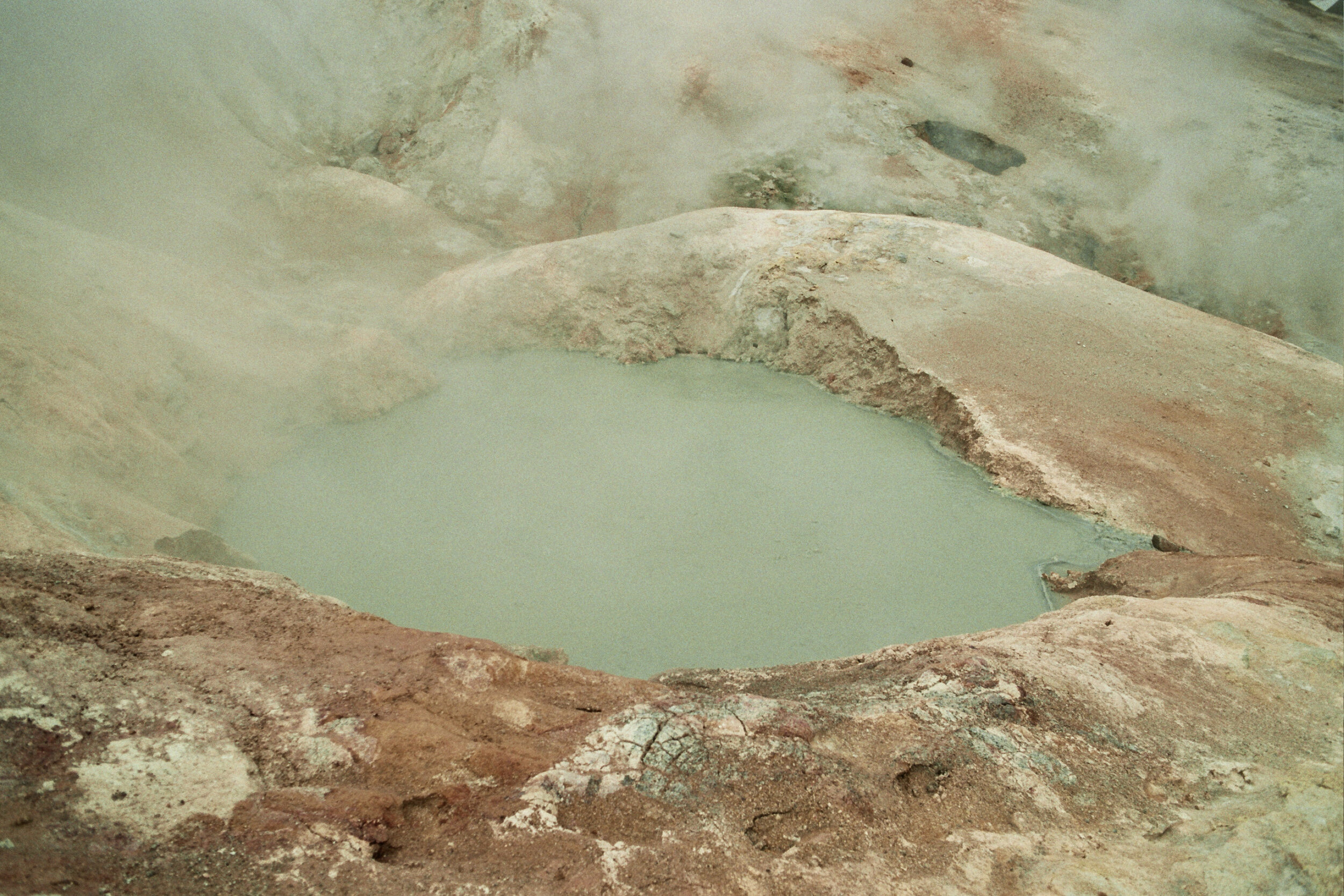
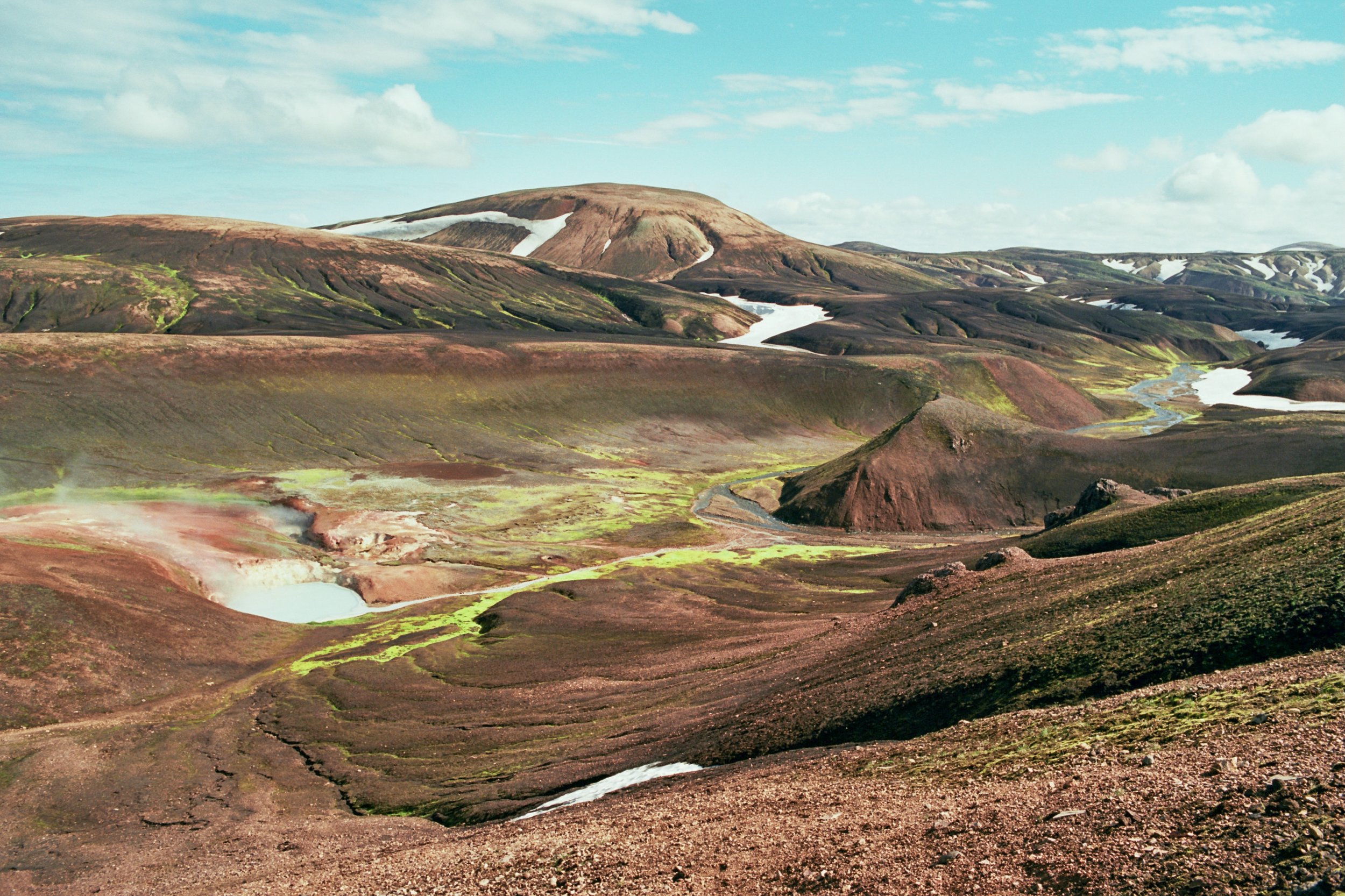
On the first day, after a few kilometres of walking through dense fog, we reached Hveradalir; a place well known for its geothermal activity. Here we dropped our heavy backpacks (Daniel 22kg me 17kg) and explored for a few hours the colourful rhyolite and pyroclastic landscape. The strong smell of sulphur and rising vapours from mud pools dominate the area.
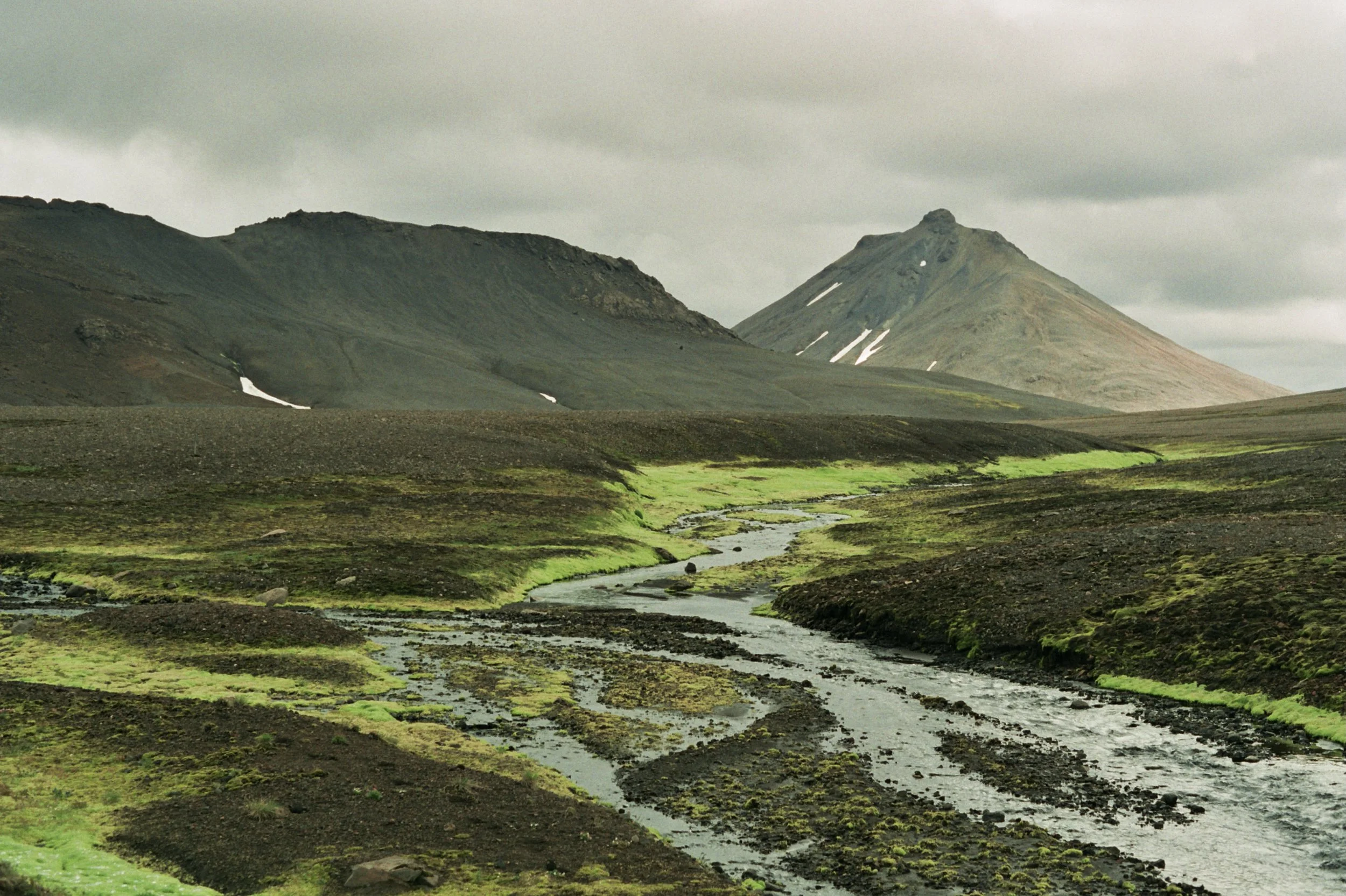
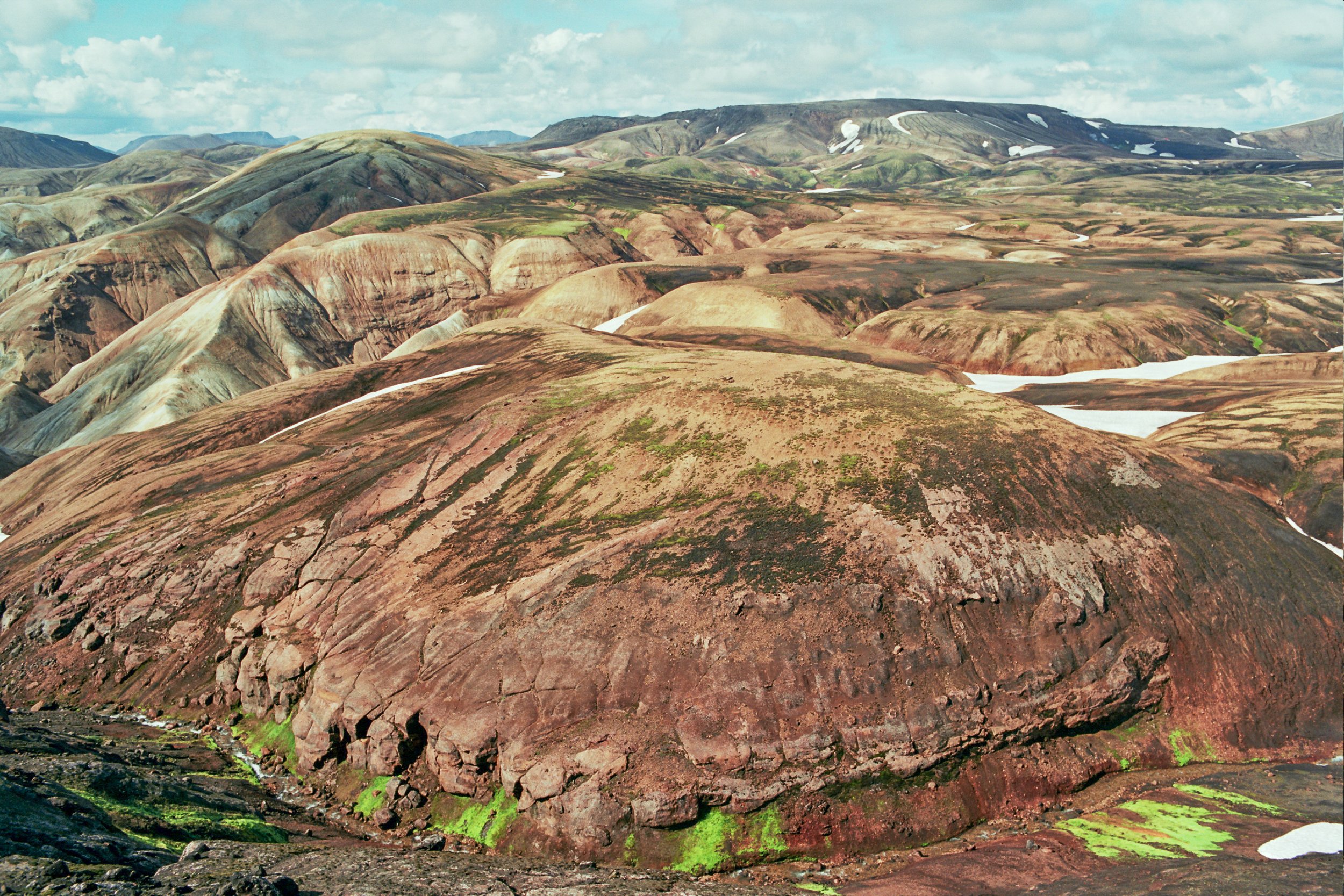
On day 2 we passed more smoky mountains, as well as snow and ice fields and neon green moss valleys.
Early in the day visibility was limited because of the fog, which made it difficult at times to orient ourselves. Snow crossings, fording of ice cold rivers and heavy rain were exciting moments, but after 12 hours of walking we arrived safe to Kisubotnar. Many saxifrages and Arctic river beauties coloured the wet sheltered valleys.
Because of the cold and rainy weather (and wet clothes and shoes from the day before) we spent half of day three in the tent, reading and drinking soup. Once the sky cleared up a little, we started walking the last bit of the trail. Black (of the rocks) white (the snow) and green (moss) were surely the dominant colours of this day.
At the end of our trail, we could relax in a thermal pool, a short walk from Ásgarður.


Graenihryggur hike 26km
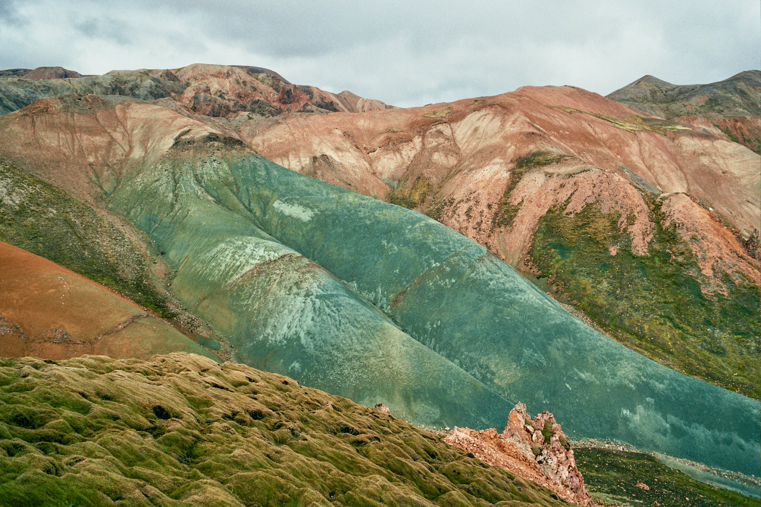
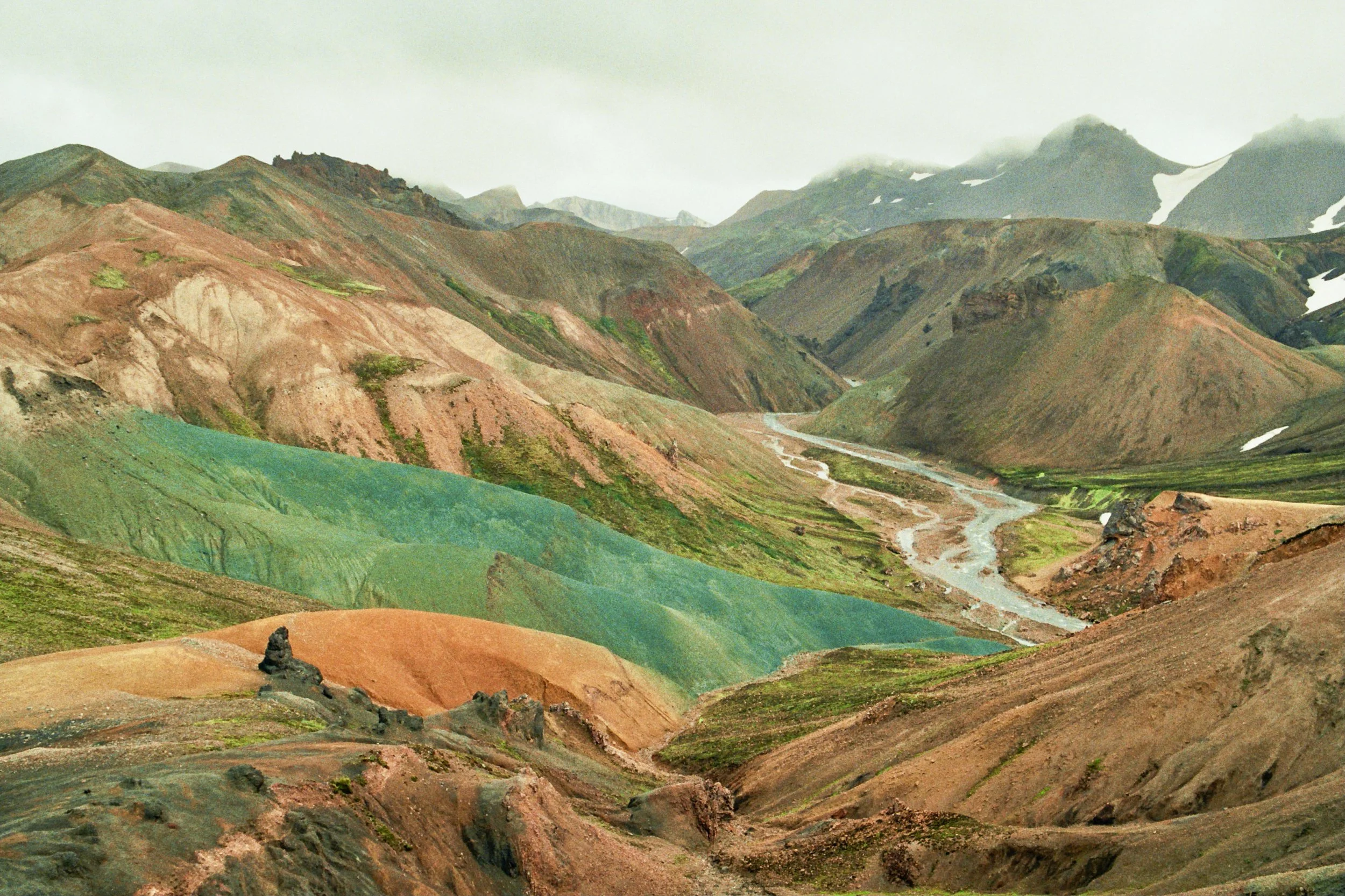
While researching walks in Iceland, I came across this fascinating blue mountain. The hike is not described in the guide book or pointed on the map. Online I could only find organised tours taking people there. We did find a route on maps.cz and thus decide to try and find it.
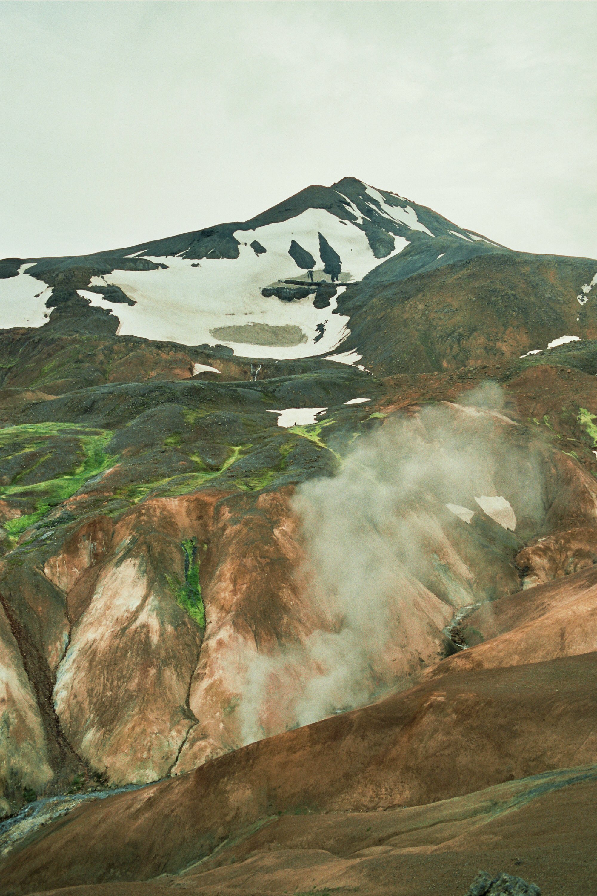
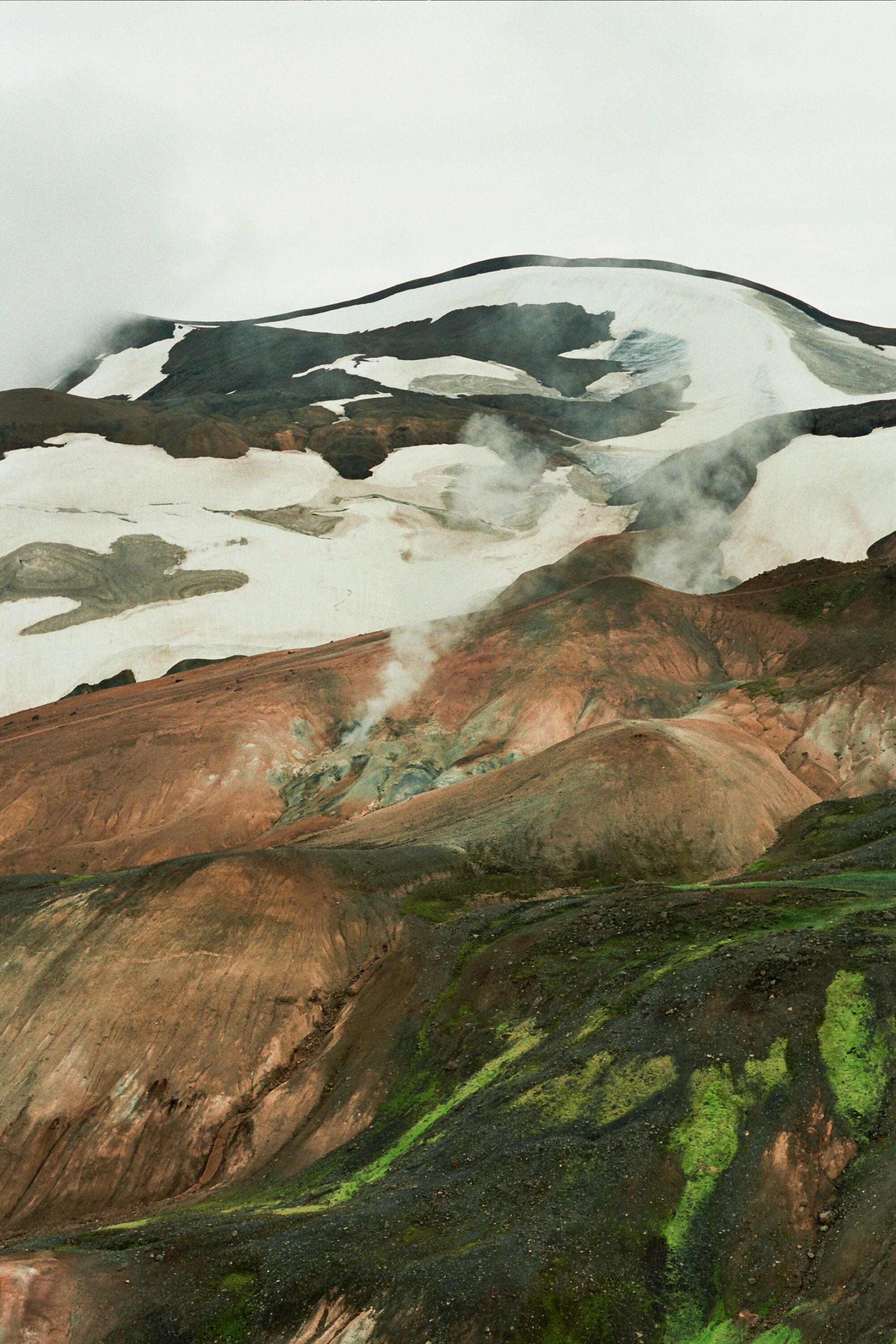
From Selfoss we hitchhiked to Landmannalugar. The road through the Highlands is only accessible with a 4x4, and makes quite an exciting ride. In Landmannalaugar (the starting point of many hikes), we asked the ranger for more information on the ‘Blue Mountain’ hike. She explained it’s an advanced hike and the trail is unmarked, then indicated how to get there and gave us permission to camp in the Hattver valley on the first night. In the morning, after fording a large river, a steep ascent and crossing of a snow bridge, we reached a big plateau with great views over the surrounding rhyolite mountains. Red, orange, yellow, blue, green, brown coloured mountains. From there we walked shortly on the ridge till we reached the beautiful blue mountain.


Laugavegur trail (The Hot Spring Route) and Fimmvörðuháls hike (+extra) 84km
We completed the popular Laugavegur trail in half the time, two days instead of four (we walked day 1&2 in one day and day 3&4 in another). Then we continued on the Fimmvörðuháls hike for another (long) day.
Day 1: Landmannalaugar-Hrafntinnusker-Álftavatn
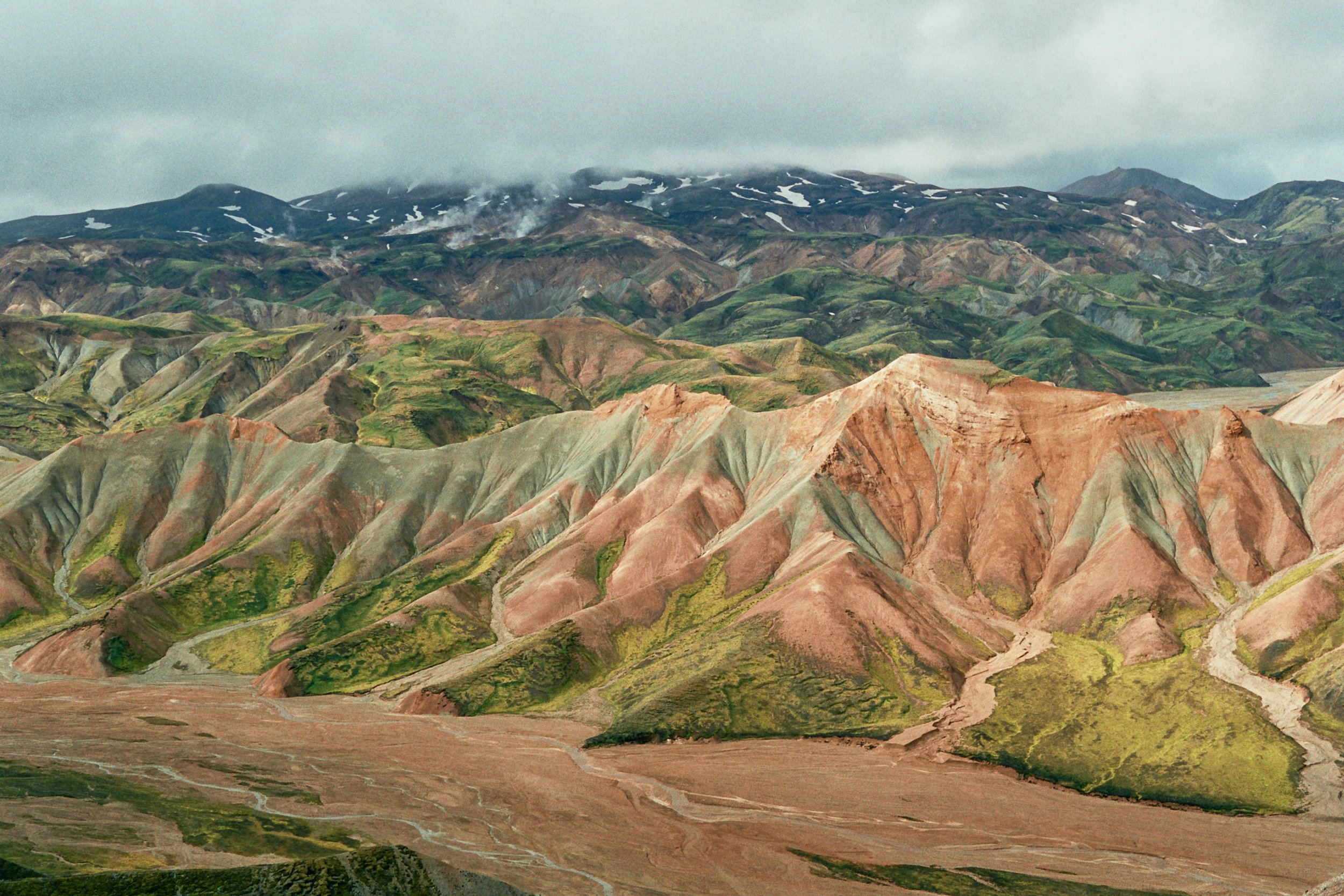
We started the trail with a short detour to the summit of the colourful mountain Brennisteinsalda.
The route passes many hot springs, fumaroles and solfataras. Probably the most exciting part of the day was the exploration of an ice cave. After crossing many rivers and snow bridges, we slowly left the rhyolite mountains behind and encountered dark palagonite mountains with intensified green vegetation. At the end of the day we camped next to a lake.
Day 2: Álftavatn-Emstur-Þórsmörk
This part of the trail involved the crossing of a lava desert and fording of some big rivers. Thrift and campion added little colour to the otherwise bleak desert. It was the longest (34km) and most tiring day of the trek. Towards the end of the day the change in landscape was noticeable; we encountered native trees for the first time in Iceland. That is, trees bigger then the 20 mm dwarf willow which is quite common in the highlands. The kjarr or birch forests, which followed not long after, were a welcome change of habitat, full of birds, mushrooms, wood cranes bill and Iceland moss.
Day 3: Þórsmörk-Fimmvörðuháls-Skógar
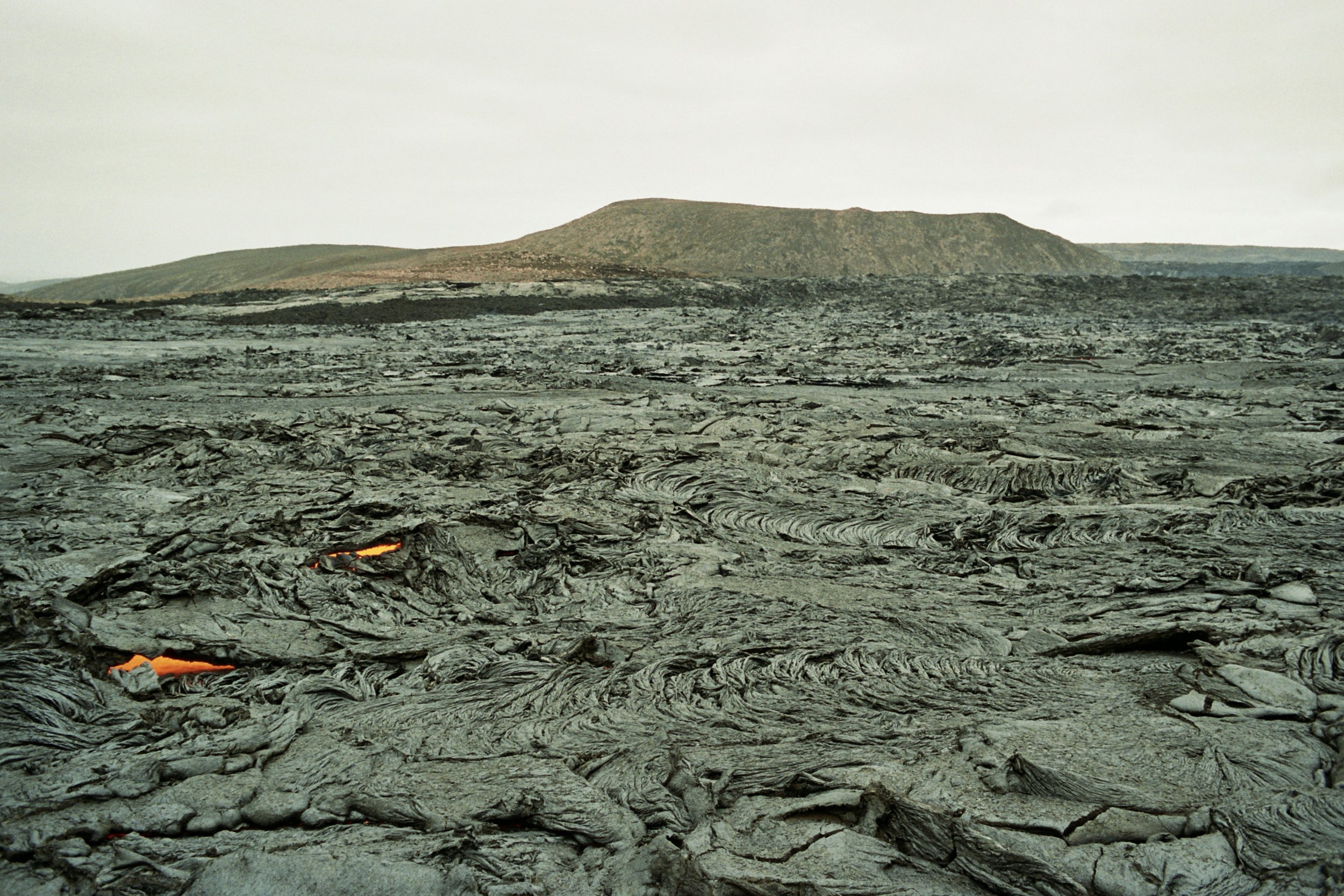
This hike runs through a gap between two glaciers, Mýrdalsjökull and Eyjafjallajökull. After an ascent of 1000m (including a small portion with chains) we arrived at a plateau, where the volcanic eruption in 2010 occurred. The only 10 years old lava field was surely impressive. Here we had very strong wind. We descended on the western side of the route instead of the traditional east side. Though 2km longer, it was more quiet and we could get very close to the glacier. Throughout the descent we passed about twenty waterfalls, one more beautiful than the other.
From Skógar we hitchhiked to Vík. The couple that picked us up also stopped on the way to see the puffin colony at the Dyrhokaey reserve. In Vík we resupplied food, washed our clothes and finally took a shower.


Skaftafell National Park 44km
Public transport turned out to be quite a hassle in Iceland. Since the focus is mostly on car tourism, we figured we could try hitchhiking for getting places. And it worked just perfect! This is how we also got from Vík to Skaftfell National Park.
Here we did several day hikes:
-Kristinartindar summit, where we had amazing views over Morsárjökull and Skaftafellsjökull glaciers.
-Morsárlón glacial lake.
-Svartifoss, the dark falls, so named because of the black hexagonal basalt columns which surround it.
-turf-roofed houses of Sel.
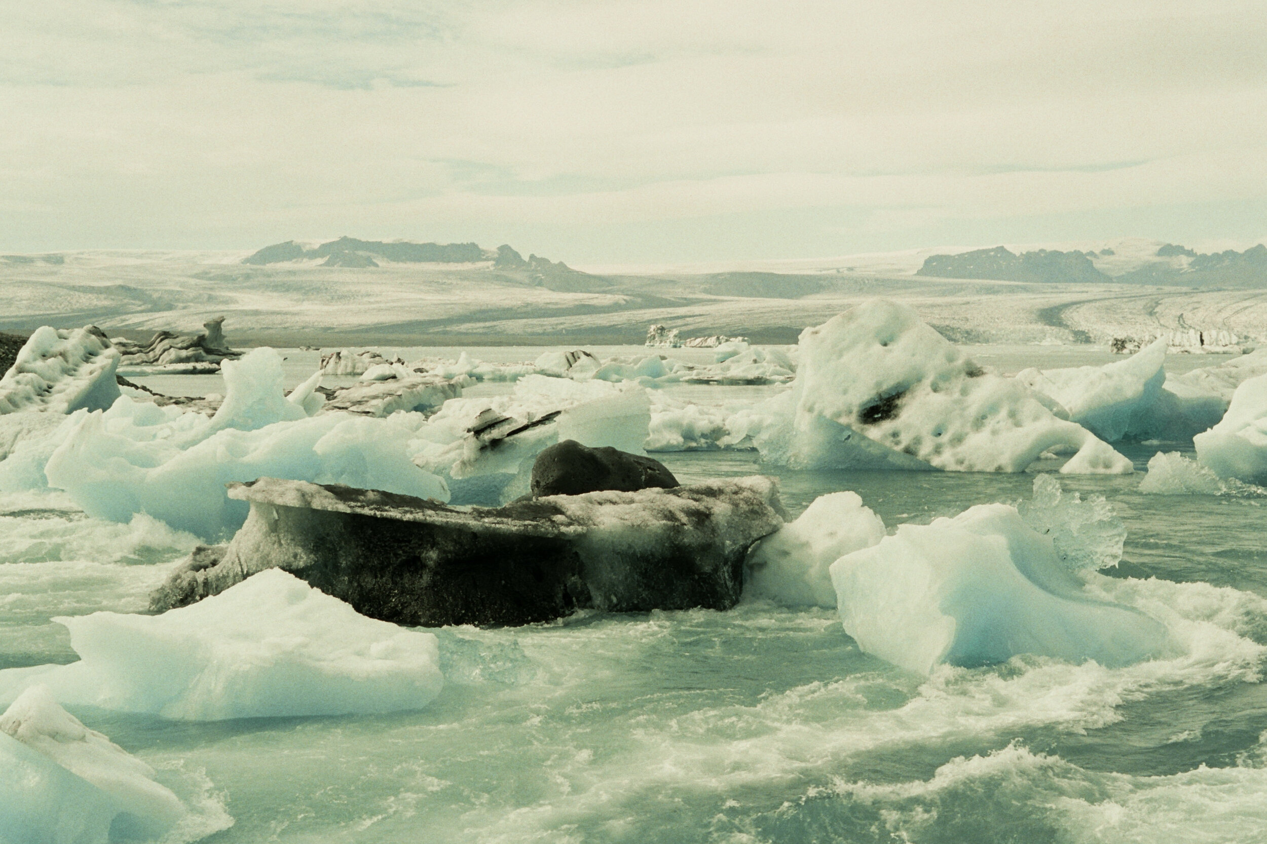
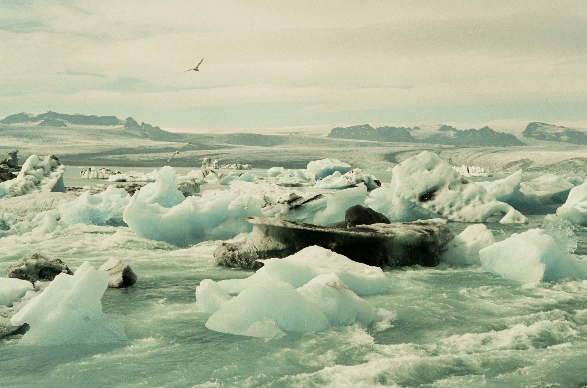
Our drive out of Skaftafell dropped us at Jökulsárlón glacial lake, where we shortly watched big icebergs floating and spotted playful seals.


Eastfjords, Víknaslóðir trail 66km
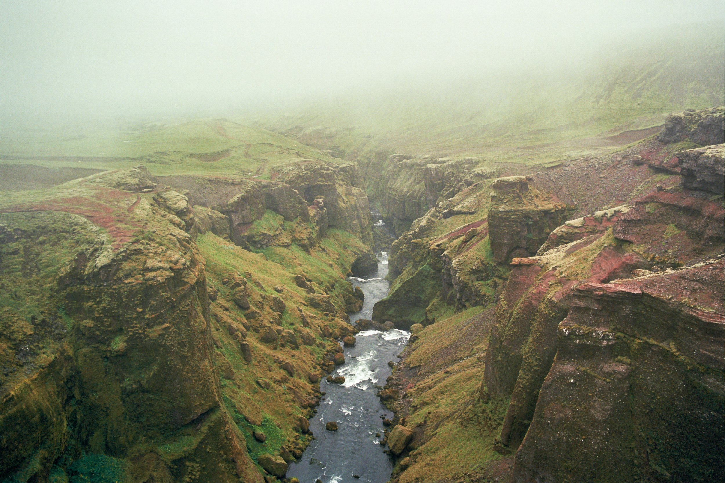
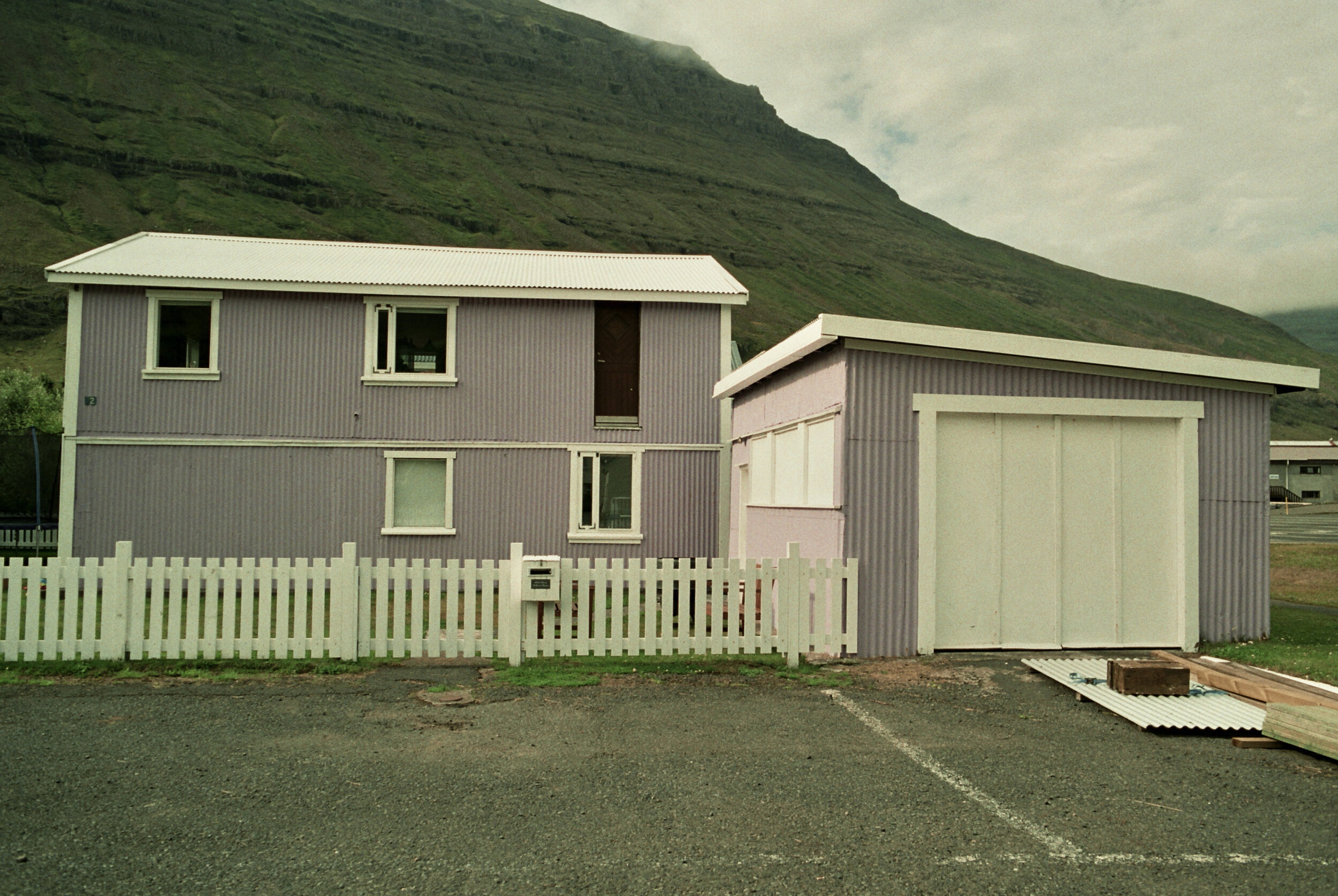
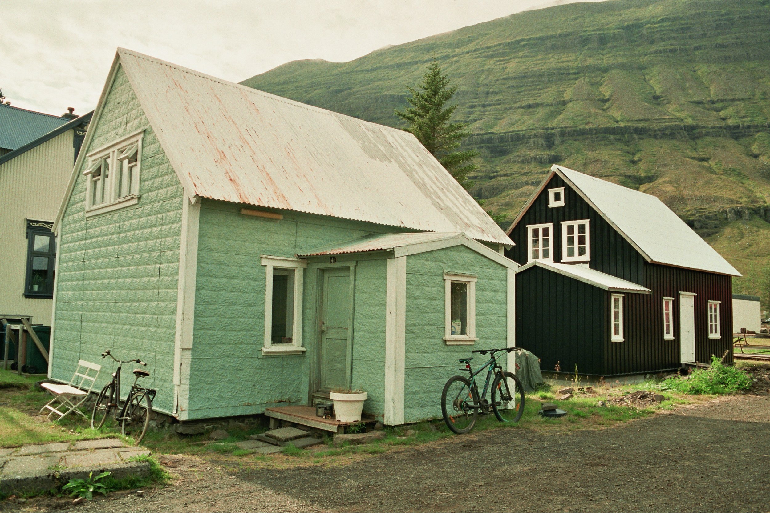
After 400km of hitchhiking (from our last stop, Skaftafell), we finally arrived at the starting point of our trek in the Eastfjords, Seyðisfjörður village. The houses here are painted in cheerful colours like blue, green, red, yellow, orange or purple. All through our walk from Seyðisfjörður to Bakkagerði we didn’t have much view of the high mountains, because of the dense fog. So, since we couldn’t admire the landscape, during our walk we searched and collected beautiful stones. Memories from this hike are: wind, wet shoes, sheep, moss, fog, more wind, bird cliffs, rain, cold.


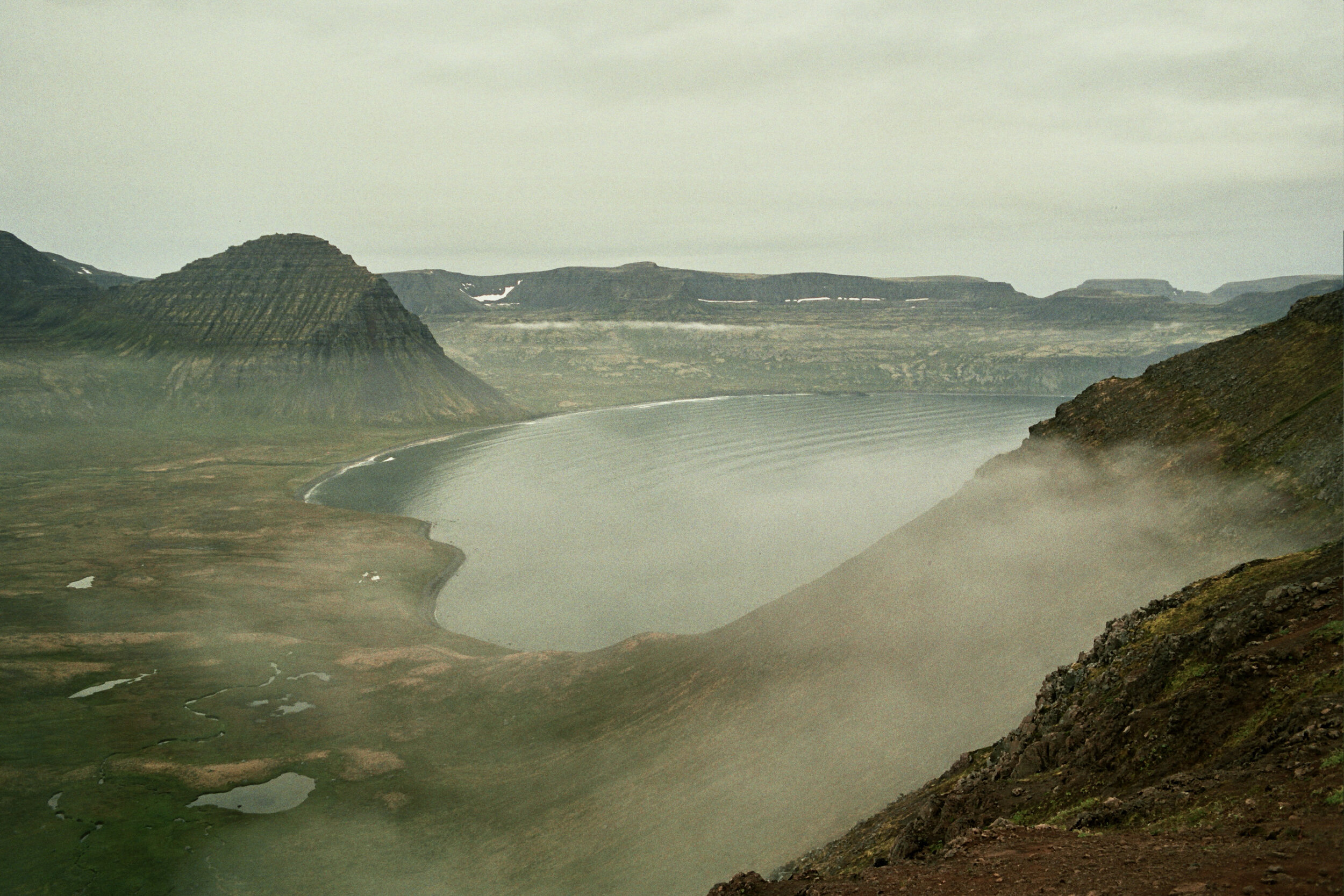
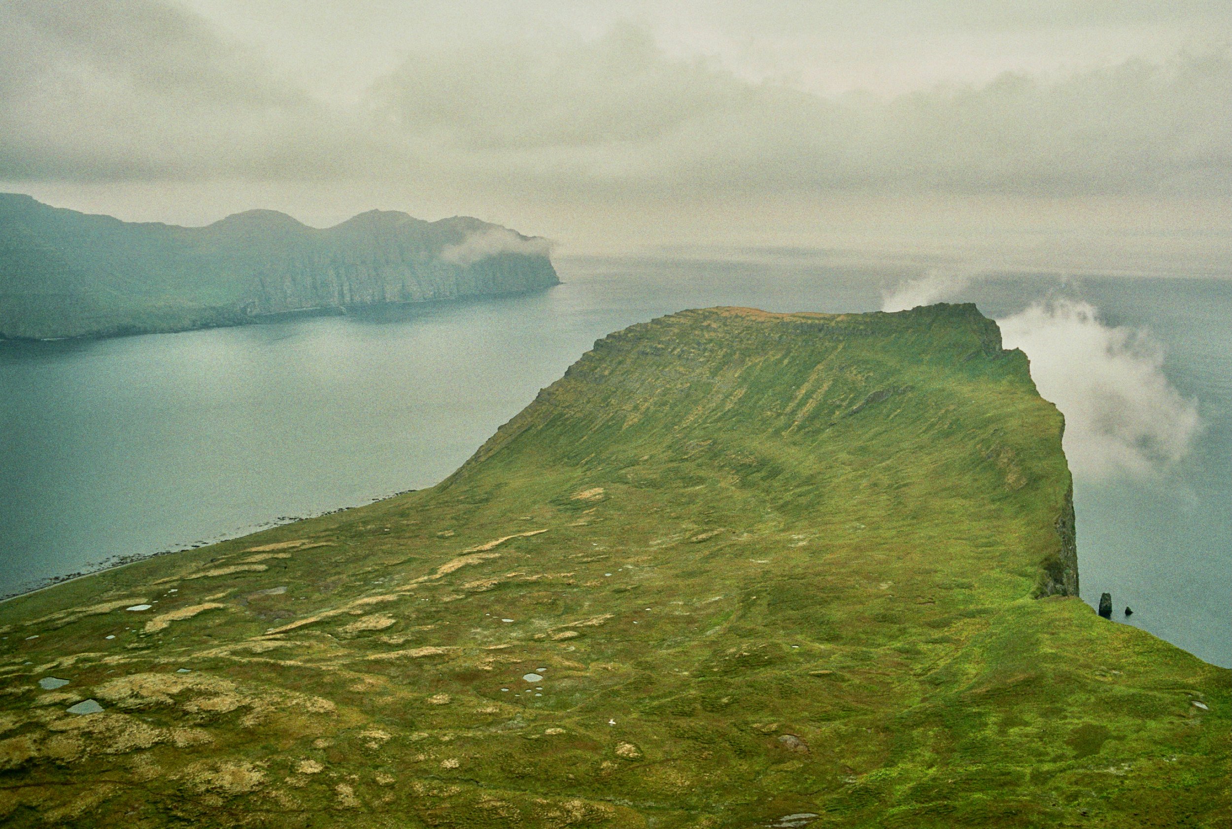
Westfjords, Hornstrandir 70km
Hornstrandir peninsula is the most remote region of Iceland. Because there has been no agriculture in Hornstrandir for decades, nature has developed here freely. It is a protected nature reserve, rich in flora and fauna. We were told by the ranger Bill Gates was not permitted to get to Hornstrandir by helicopter in order not to disturb the wildlife; he had to get here by ferry, like everyone else. We arrived in Ísafjörður after 12 hours on the road and changing 3 different buses from Egilsstaðir. The morning after we took the ferry to Hesteyri, our starting point of the trail. Fulmars flew along with our boat. We even spotted several humpback whales. In total we spent five days in Hornstandir, climbing many cliffs and walking from one beautiful bay to another. We especially enjoyed observing the many birds, lazy seals and the playful arctic foxes.


Fagradalsfjall volcano 30km